Zoning in NSW is the legal classification set by your council’s Local Environmental Plan, made under the Standard Instrument, that decides what a property can legally be used for and what can be built on it. The single most important action before making an offer is to search the address on the NSW Planning Portal Spatial Viewer and read the land use table for that zone in the local LEP. Overlays like flood mapping, height limits and heritage listings often matter more than the zone label itself.
TL;DR:
- The Land Use Table and overlays, such as height limits and heritage listings, are more critical than zone labels when assessing a property’s development potential.
- Local councils can vary permitted uses within the same zone code like R2 Low Density Residential, so always verify the specific land use rules for each property.
- Overlays like flood, heritage, and bushfire-prone land often impose stricter development restrictions than the zone itself, requiring careful checking before purchasing.
- Running a zoning check on the NSW Planning Portal Spatial Viewer, layering overlays, and requesting an official Section 10.7 certificate provide the most reliable due diligence.
- Stopping at just identifying the zone color is risky; detailed evaluation of the Land Use Table and overlays is essential before negotiating or making an offer.
Table of Contents
- What zoning laws in NSW actually cover
- NSW zoning classifications: a quick reference guide
- How to check a property’s zoning using the Spatial Viewer
- Overlays and development standards that override the zone label
- What zoning means for buyers: checks and red flags before you sign
- Where professional help changes the outcome
- The checklist beats the checklist-avoidance instinct
- Sources
- FAQ
What zoning laws in NSW actually cover
NSW zoning runs on a two-tier system. The Environmental Planning and Assessment Act 1979 sets the legal framework, and the Standard Instrument (Local Environmental Plans) Order 2006 gives every council in the state a common template of 35 standard zones to choose from. Each council then builds its own Local Environmental Plan around that template, mapping which zones apply where and writing a Land Use Table that spells out what is allowed in each one.
This is where things get interesting for buyers. Two councils can both have an R2 Low Density Residential zone, yet permit different things within it, because the Standard Instrument fixes the zone names but lets councils vary the detail. A handful of points worth holding onto:
- The Act and Standard Instrument set the rules; councils apply them locally through LEPs.
- Every LEP has its own Land Use Table listing what’s permitted, permitted with consent, or banned outright.
- The same zone code can behave differently from one council area to the next.
- A generic definition of a zone code tells you far less than the actual local table.
NSW zoning classifications: a quick reference guide
Recognising the common codes speeds up how fast you can read a planning map, but treat every description below as a starting point, not a final answer, since local councils tweak the detail constantly.
- R1 General Residential — broad housing zone, typically allows a mix of dwelling types including multi-dwelling housing.
- R2 Low Density Residential — the classic detached-house zone in established suburbs.
- R3 Medium Density Residential — townhouses, villas and low-rise apartments alongside houses.
- R4 High Density Residential — apartment buildings, usually near transport and centres.
- R5 Large Lot Residential — semi-rural residential blocks, often on the urban fringe.
- RU zones (RU1, RU2, RU4, RU5, RU6) — rural production, rural landscape, and small-scale rural living.
- B zones (B1–B7) — business and commercial uses, from neighbourhood shops to core CBD centres.
- C2 Environmental Conservation — land where the priority is protecting ecological value, with most residential and commercial development prohibited or heavily restricted.
- MU1 Mixed Use — combined retail, commercial and residential development in one zone.
- E zones (E1–E5) — a newer environmental zone family covering conservation, working environments and rural landscapes.
The caveat that matters most: councils decide, zone by zone, whether their Land Use Table runs an “open” or “closed” approach, which changes whether an unlisted use is automatically prohibited or potentially permissible. Never assume a zone code means the same thing two suburbs over.
How to check a property’s zoning using the Spatial Viewer
Checking zoning yourself takes minutes and costs nothing. Here’s the process professional planners and builders actually use before they commit time to a design or a development application.
- Switch on the “Land Zoning” layer and click the parcel. This reveals the zone name and links straight through to the relevant LEP clause and Land Use Table entry.
- Layer in the overlays. Height of buildings, floor space ratio, heritage, flood, and bushfire-prone land maps all sit as separate layers you can stack on top of the zoning map, and stacking them is exactly how practitioners test development potential rather than relying on the base colour.
- Escalate when the picture gets murky. If overlays conflict, if the map looks outdated, or if you’re weighing a serious purchase, request a council Section 10.7 certificate or book a pre-DA meeting with a council planner.
Pro Tip: Never judge a property by the zoning colour alone. Two blocks with the identical R3 tag can have wildly different building envelopes once you layer in height limits, minimum lot size and a heritage overlay. Check the numbers, not just the colour.
Overlays and development standards that override the zone label
A zone tells you the intended use. Development standards and overlays tell you the actual limits, and they frequently do more to shape a project than the zone itself.
- Floor space ratio (FSR) caps total building floor area against site area, directly limiting how big a new build or extension can be.
- Maximum building height sets a hard ceiling, usually in metres, sometimes also expressed in storeys.
- Minimum lot size determines whether a block can be subdivided or used for dual occupancy.
- Setback controls dictate how close a structure can sit to boundaries, streets and neighbouring properties.
- Heritage listings can restrict demolition, alterations, or even paint colours on a facade.
- Flood planning and bushfire-prone land overlays add extra construction requirements or block development outright in high-risk zones.
- Contaminated land and biodiversity mapping can trigger remediation costs or conservation conditions before any consent is granted.
These controls sit inside the LEP, but the local Development Control Plan often adds another layer of detail on top, covering things like car parking ratios or streetscape requirements that the LEP itself doesn’t touch.
What zoning means for buyers: checks and red flags before you sign
Turning all this into a buying decision comes down to a short, disciplined checklist rather than a general sense that “the zoning looks fine.”
- Confirm the exact permitted use you intend (renovation, subdivision, secondary dwelling) against the Land Use Table, not just the zone name.
- Layer every relevant overlay, especially height, FSR, heritage, flood and bushfire, before assuming a development is viable.
- Request a Section 10.7 certificate from council for the official, legally reliable record of planning controls and constraints.
- Search council records for current planning proposals or recent LEP amendments that might change the rules after settlement.
Certain findings should slow you down immediately: a heritage listing you weren’t told about, a flood planning overlay across most of the block, contamination flags, or a Land Use Table entry that prohibits your intended use outright. Any of these justifies a pause and a call to a town planner, surveyor, or property lawyer before you go firm on an offer, and a title search alongside your zoning check rounds out the legal picture.
Pro Tip: If you’re buying a strata unit rather than a house, zoning still matters, but by-laws and unit entitlements often do more to determine what you can actually change. Check both before assuming zoning alone tells the full story.
Where professional help changes the outcome
Reading a zoning map is straightforward. Interpreting what it means for a specific negotiation, especially under auction pressure or on an off-market deal with limited due diligence time, is a different skill entirely. A buyers agent’s job in this context is to verify the spatial layers properly, chase down the Section 10.7 certificate, read the Land Use Table against your actual intentions, and form a view on how likely council is to approve a given development.
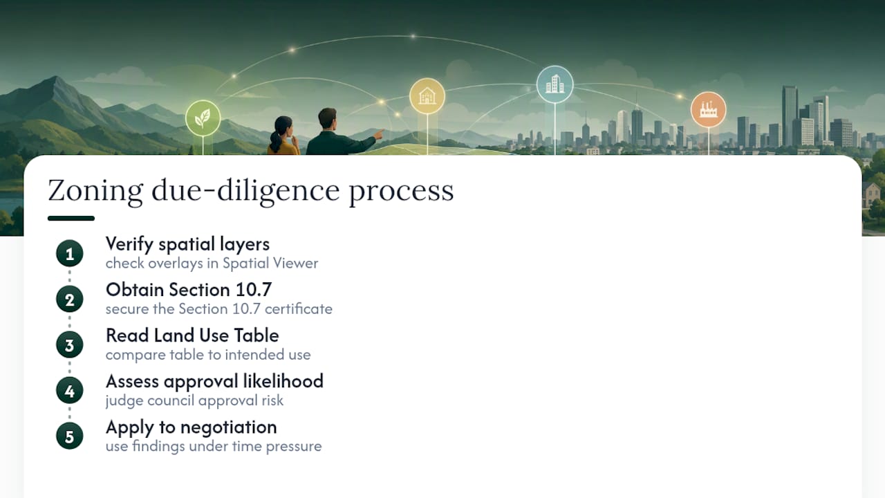
That matters most in three situations: off-market purchases where you can’t rely on a vendor’s disclosure pack, auctions where you have days rather than weeks to check overlays, and properties sitting across two or more zoning constraints at once. Sydney Property Buyers works across Inner West, Eastern Suburbs, Lower North Shore and Eastern Beaches Sydney, and its full-service offering folds zoning and planning due diligence into the broader appraisal and negotiation process, rather than treating it as a separate step buyers have to manage alone.
The checklist beats the checklist-avoidance instinct
Most zoning advice online tells buyers to “check the zoning,” full stop, as if that’s a single action rather than a process with several failure points. It isn’t. The zone label is the least useful piece of information on the map. The Land Use Table entry for your specific intended use, and the overlays sitting on top of the zone, do the real work of telling you what’s achievable.
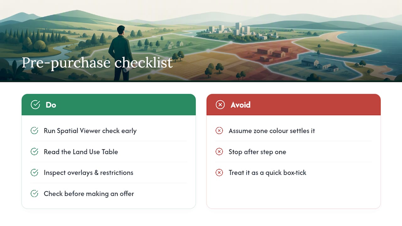
The most common mistake isn’t skipping the check entirely. It’s stopping after step one, seeing a residential zone colour, and assuming that settles the matter. An R2 block with a heritage overlay and a minimum lot size clause behaves nothing like an unencumbered R2 block next door. Buyers who treat the Spatial Viewer as a five-minute box-ticking exercise miss exactly the detail that determines whether their renovation, subdivision or dual occupancy plan is even legally possible.
If there’s one priority to take from all this: run the Spatial Viewer check and the Land Use Table read before you fall in love with a property, not after. It costs nothing, takes minutes, and it’s the difference between negotiating with confidence and finding out three weeks into due diligence that your plans were never viable.
— Kristan
FAQ
What is zoning in NSW?
Zoning in NSW is the legal classification a council assigns to land through its Local Environmental Plan, made under the Standard Instrument, which determines what uses and developments are permitted on that land.
How do I find out what zone my property is in?
Search the address or lot and DP number on the NSW Planning Portal Spatial Viewer, switch on the “Land Zoning” layer, and click the parcel to see the zone name and its link to the relevant LEP clause.
What are the main NSW zoning codes?
The most common codes are R1 to R5 for residential density, RU zones for rural land, B zones for business and commercial uses, MU1 for mixed use, and E or C2 zones for environmental conservation, though each council’s Land Use Table sets the specific permitted uses.
What can you build on C2-zoned land in NSW?
C2 Environmental Conservation zoning is designed to protect ecological value, so most residential and commercial development is prohibited or tightly restricted. Always check the specific Land Use Table entry and consider requesting a Section 10.7 certificate before assuming any use is permitted.
Do I need a Section 10.7 certificate before buying?
A Section 10.7 planning certificate gives you council’s official, legally reliable record of the zoning, overlays and development constraints on a property, and it’s worth requesting whenever a purchase depends on future development potential.
Recommended
- Section 32 explained: what Sydney buyers need to know
- Strata by-laws in NSW: what buyers and owners need to know
- 3 Proofs Buyers in Australia Need: Pre Settlement Inspection Checklist
- What is a property title search? Your 2026 guide