For any Sydney address, two official sources matter: Airservices Australia’s Aircraft in Your Neighbourhood portal (which houses the ANEI contours and an interactive address lookup) and Sydney Airport’s flight path and noise pages. Live third-party heatmaps, such as FlightPathNoise, show what’s flying overhead right now, but they’re not a substitute for ANEI’s long-term averages.
- ANEI answers “how noisy is this suburb, typically, over a year?”
- Live heatmaps answer “what’s flying over this street, right now?”
- Sydney Airport’s pages cover ground-based noise and general flight path context
Pro Tip: If you’re weighing up a property purchase, start with ANEI for the long-term picture, then check a live map at a few different times of day to catch anything the yearly average smooths over.
Key Takeaways
Checking a Sydney property against Airservices’ ANEI contours and a live flight tracker, at more than one time of day, gives buyers a far more reliable noise picture than either map alone.
| Point | Details |
|---|---|
| Start with ANEI | Use Airservices’ Aircraft in Your Neighbourhood portal for the long-term averaged exposure band. |
| Add a live check | Cross-reference with a live heatmap or WebTrak to see actual recent flight activity. |
| Check multiple times | Runway modes shift through the day under the Long Term Operating Plan, so one snapshot isn’t enough. |
| Report through NCIS | Airservices’ Noise Complaints and Information Service is the official channel for in-flight noise reports. |
| Get expert inspection support | Sydney Property Buyers runs independent inspections at representative times to document noise before you commit. |
Table of Contents
- What aircraft noise maps exist and who runs them?
- How do you check aircraft noise at a specific address?
- Which Sydney suburbs experience the most aircraft noise?
- How accurate are these maps, and what are their limits?
- How do you report aircraft noise and who investigates it?
- How should buyers use noise maps before purchasing?
- Get an independent noise check before you buy
- Sources
What aircraft noise maps exist and who runs them?
Three organisations produce the maps that matter for Sydney. Airservices Australia runs the Aircraft in Your Neighbourhood portal, the ANEI contour maps, and both long-term and short-term noise monitoring. Sydney Airport publishes noise management resources and handles ground-based noise, referring in-flight matters to Airservices. Western Sydney International has its own overflight noise tool, increasingly relevant as its detailed flight path design and community engagement work progresses ahead of opening.
Alongside these, live flight-tracking tools and heatmaps (including WebTrak, linked from the Airservices homepage) let you watch actual aircraft movements in near real time. They’re excellent for spotting a specific noisy event but tell you nothing about whether that suburb is noisy on average.
Airservices handles in-flight aircraft noise and complaints. Sydney Airport handles ground-based noise, such as engine testing and taxiing. Get the wrong one and your enquiry goes nowhere.
How do you check aircraft noise at a specific address?
The fastest check uses Airservices’ address lookup inside Aircraft in Your Neighbourhood, cross-referenced with Sydney Airport’s flight path overlays.
- Open the Aircraft in Your Neighbourhood portal and enter the street address or suburb.
- Read the ANEI contour band the property sits within, using the map legend to convert colour bands into decibel ranges.
- Switch to a live heatmap or WebTrak to see actual flight activity over recent hours or days.
- Check any available flight-track layer to see which specific corridors pass closest to the property.
- Repeat the live check at different times, since morning departures and evening arrivals often use different runway modes.
What you’re recording matters as much as where you look:
- The ANEI band (this is an averaged annual exposure figure, not a single day’s noise)
- Date and time of any live events you observe, plus rough frequency
- Runway mode notes if visible (some tools indicate which runway configuration is active)
- A screenshot or saved view for later reference
An ANEI band tells you the property’s yearly averaged exposure category. A live heatmap tells you what happened at 7:14am on a Tuesday. Neither replaces the other.
Which Sydney suburbs experience the most aircraft noise?
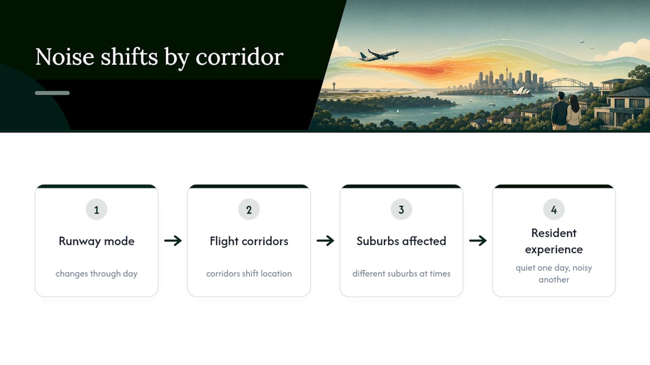
Exposure follows flight corridors, not postcodes, and it shifts with runway use. Inner southern and inner western suburbs under the main approach and departure paths tend to see more frequent overflights, and parts of the eastern suburbs pick up noise depending on which runway mode is in use on a given day. Sydney Airport sits nine kilometres south of the CBD on Botany Bay, and its three-runway layout means noise sharing shifts considerably through the day.

The Long Term Operating Plan spreads noise across different corridors at different times specifically so no single suburb bears the full load constantly. This is why a suburb can feel quiet on a Tuesday afternoon and noisy on a Thursday morning.
Pro Tip: Don’t rely on ANEI alone. Cross-check it against your local council’s noise overlay (where one exists) and, ideally, do a physical inspection during a known busy departure window before you commit.
How accurate are these maps, and what are their limits?
ANEI is built from historical monitoring and represents an averaged picture of noise exposure over an extended period. This is not a live feed. It smooths out day-to-day variation, which means it can understate how noisy a bad morning actually sounds while accurately reflecting the yearly pattern.
Live heatmaps and flight-tracking tools show the opposite problem: an unusually busy day caused by weather diversions, a runway closure, or a temporary flight path change can make an area look noisier than it typically is.
- ANEI does not capture short-term surges or one-off events
- Live tools carry no long-term context, so a single snapshot can mislead
- Neither tool automatically reflects night curfew rules or temporary runway works
- WSI’s approach includes measures like Reciprocal Runway Operations and RRO-NAP overnight, plus an Environmental Monitoring Program running over an initial multi-year baseline period starting in 2026
That WSI monitoring window matters if you’re assessing a Western Sydney property, since the baseline data itself is still being established.
How do you report aircraft noise and who investigates it?
Airservices Australia’s Noise Complaints and Information Service (NCIS) is the official channel for in-flight noise reports, accepting both phone reports and WebTrak submissions.
When you report, include:
- Suburb and street address
- Date and approximate time of the event
- Flight number if you captured one from a live tracker
- A screenshot from WebTrak or a heatmap, where possible
Airservices will investigate and explain what occurred, but it cannot halt operations on the spot. Complaints are logged and can feed into longer-term route or procedure reviews where genuinely feasible.
How should buyers use noise maps before purchasing?
Treat map data as one input in a wider due diligence process, not a single yes or no test; for detailed insights and suburb analysis, consider consulting Property Investment News & Insights Australia from Wealth Nest. A sound approach looks like this:
- Run the ANEI check for the exact address, not just the suburb
- Capture live activity at two or three different times, including an early morning departure window
- Confirm whether council planning overlays reference aircraft noise for that zone
- Schedule at least one inspection during a known busy period, not just a quiet Sunday afternoon
Document everything for negotiation purposes: screenshots, the ANEI band, notes on what you personally heard, and any correspondence with council if the property sits near a contested corridor. For properties in higher-exposure bands, an independent acoustic report can justify a price adjustment or inform a conditional offer. This kind of evidence is exactly what strengthens a negotiating position rather than a hunch about “it seemed a bit loud.”
Sydney Property Buyers builds these checks into inspections for suburb research on noise-sensitive purchases, treating flight path data as standard due diligence rather than an afterthought.
A buyer’s agent’s take on noise maps
Maps are a filter, not a verdict. I’ve seen buyers write off a genuinely good street because an ANEI band looked alarming on screen, and others buy without checking at all. The right approach sits between the two: use the map, then stand on the street.
Get an independent noise check before you buy
Sydney Property Buyers gives buyers something a map alone can’t: someone on the ground checking a property at the times that actually matter, not just when an open home happens to fall.

Full Service clients get independent inspections conducted seven days a week, meaning a property under a departure corridor can be checked during a genuine peak window rather than a quiet Sunday. Where noise findings are significant, that evidence feeds directly into negotiation strategy and, where a corridor is genuinely unsuitable, into the search for off-market alternatives away from the busiest flight paths. Negotiation Only clients can also ask for a noise-sensitivity check to be added to their brief before an offer goes in.
If you’re assessing a property near a flight corridor, get in touch on 1800 676 177 or hello@sydneypropertybuyers.com.au, or read more about how the agency’s process works from search to settlement.
Sources
- Aircraft noise – Airservices
- Aircraft noise – Sydney Airport
- Western Sydney International (Nancy‑Bird Walton) Additional measures to support the opening of the airport